Purple Lizard Map – Rothrock 7th ed.
Original price was: $17.00.$13.60Current price is: $13.60.
- Satisfaction Guaranteed
- Easy Returns
- Secure Payments
- Exclusive Deals
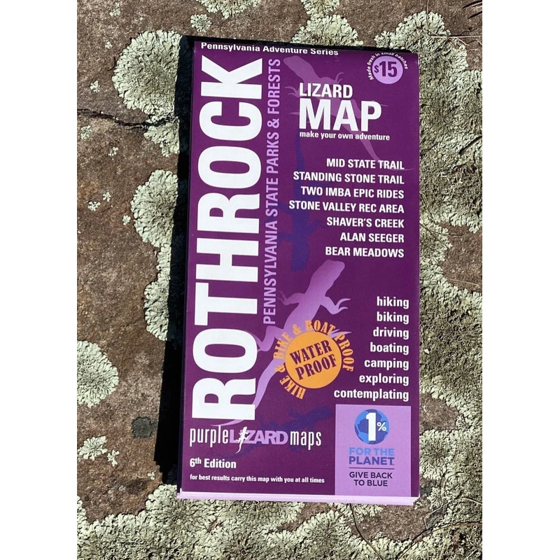
The Rothrock Lizard Map will help you plan all your adventures in and around Rothrock State Forest, located minutes from State College and Penn State.
The Rothrock State Forest was the first Lizard Map (initially published in 1997)and isstill one of our most popular and favoritemaps! Folks come from all over to bike, hike and explore Rothrock. Just a few hours from Philadelphia, Baltimore, DC, New York and Pittsburgh,Rothrock State Forest offers manyadventures worth the trip.
These maps are AMAZING! They make trip planning for bikepacking so easy.I am a customer and fan for life – thank you! Bradfrom PA
A beautifully designed, easy to read topographic map featuring contour lines, elevation data, shaded relief, and all the key details you need to plan your adventures: backroads and trails, trail use designations, road surfaces (paved/gravel/4wd), parking access, campsites, public lands, historic sites and more.
A REAL MAP FOR PEOPLE WHO LOVE REAL-WORLD EXPERIENCES
Lizard Maps are durable, waterproof, and give you the big picture the map opens to 24 x 36 and folds easily to 4 x 8 to fit in your back pocket. The scale is 1:39,450 (1 inch = 0.6 mile). Includes both lat./lon. and UTM coordinate systems.
Public land:90,000 acres of Rothrock State Forest, part of Bald Eagle State Forest, as well as Greenwood Furnace, Whipple Dam and Penn Roosevelt State Parks, the Penn State Stone Valley Forest, Mount Nittany Conservancy Trail System and Preserve and parts of State Game Lands 112, 118, 322.
Destinations:Alan Seeger Natural Area which has a stand of old growth hemlock and Bear Meadows Natural Area, which is among the largest freshwater bogs in the northeast.
Roads:all Lizard Maps show which roads are paved, dirt/gravel or 4wd roads as well as which are gated. Perfect for bicyclists, dual sport riders and overlanders looking to put together a remote backcountry route across public lands.
Major hiking trails:the Rothrock SF section of the 323-mile Mid State Trail (MST) shown from the MST Tunnel under Route 322 at Seven Mountains to Water Street, PA. The MST continues on the Purple Lizard Bald Eagle Lizard Map. The 84-mile Standing Stone Trail (SST) is shown from Game Lands 112 to its northern terminus with the Mid State Trail at Detweiler Run. The Mount Nittany Conservancy trails are a local favorite offering outstanding views of the town of State College and surrounding valleys.
Major biking trails:include two nationally recognized IMBA Epic Rides: the 36-mile Rothrock Trail Mix (originally called the R3 Epic) and the 27-mile Coopers Gap IMBA Epic. Both are completely mapped and offer some of the very best technical singletrack riding in the Northeast.
Even more trails:Lizard Maps highlight and designate public trails and paths including hiking, biking and rail trails managed by federal, state and local authorities. Colyer Lake features a 2.5 mile trail around it built for mountain biking and running. Juniata College in Huntingdon has a network of walking paths and hiking trails around an environmental art installation by Maya Lin. In Rothrock, the trails of Musser and Shingletown Gap are local favorites. A network of bicycle paths surround the town of State College and connect to Rothrock State Forest. The northern end of the Lower Rail Trail is shown at Water Street.
Points of interest:campgrounds, picnic areas, climbing areas, reservable car camping sites, scenic overlooks, observation towers and lizard spots.
Natural Areas and special designated areas:include Alan Seeger Natural Area, Bear Meadows Natural Area, Detweiler Run Natural Area, Little Juniata Natural Area, Rocky Ridge Natural Area, Thickhead Wild Area, Colyer Lake, and the Penn State Stone Valley Forest.
Towns:Alexandria, Boalsburg, Huntingdon, Lemont, McAlevys Fort, Milroy, Potters Mills, Reedsville, Spruce Creek, State College, and Water Street, PA.
Lizards!The little purple Lizards youll find scattered on all Purple Lizard maps were born here in Rothrock! They signify an interesting spot to check out. The Legend says This Could Mean Anything: cool place, sweet view, local legend.”
Closer than you think!Just a few hours from Philadelphia, Baltimore, DC, New York and Pittsburgh,Rothrock State Forest offers manyadventures worth the trip.
Nowin the7th edition,Rothrockboasts some of the best hiking and mountain biking trails in the country. Outdoor enthusiasts will find an amazing network of backroads, stunning ridgeand valley topography, beautiful State Park lakes andcampgroundsfor everyspeed ofadventurer. Grab yours and start planning your adventures today.



 The Feather Mechanic Revised & Updated
Reviews
There are no reviews yet.